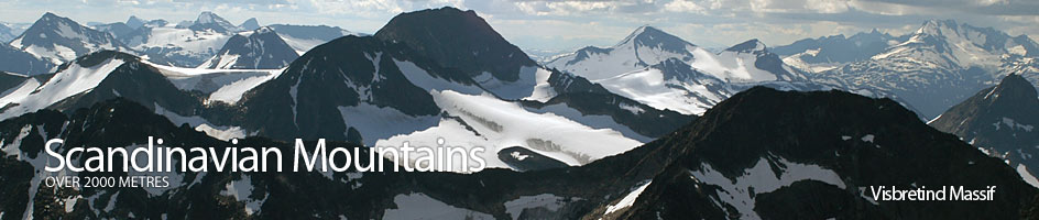
Scandinavian Mountains over 2000 metres - James Baxter
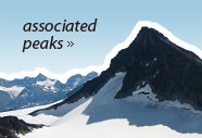
Areas › Visbretind Massif › Semelholstind › Alternative Routes
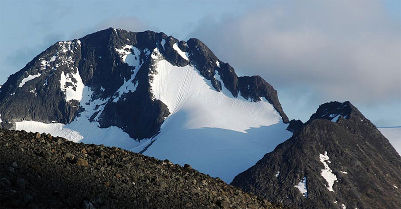
There are 4 routes up Semelholstind. 3 of these routes involve various glacier crossings and the fourth is a long climb up the north ridge. None of these routes are suitable for a solo ascent. However, a few people chance the short glacier crossing on the south of Semelholstind but this is not recommended. These 4 routes are:
- The main route from Leirvassbu lodge to Langvatnet lake then up the south flank to Sørvestre Urdadalstind and across the narrow arm of Visbreen glacier.
- The route from Spiterstulen or Gjendebu lodges via Urdadalen valley and Sørvestre Urdadalstind and across the narrow arm of Visbreen glacier.
- The glacial route from Leirvassbu or Spiterstulen lodges up the heavily crevassed main Visbreen glacier.
- The demanding climbing route up the north ridge from Leirvassbu or Spiterstulen lodge.
 The route from Leirvassbu lodge down to the west end of Langvatnet lake and then up the south side of the massif to Sørvestre Urdadalstind before crossing the narrow arm of Visbreen glacier and ascending the south flank of Semelholstind is the main preferred route and is described in more detail in the main section.
2. The Route vis Urdadalen Valley
The route via Urdadalen valley can start at either at Spiterstulen or Gjendebu lodges. From Spiterstulen lodge follow the path Vi.1 up the east side of the Visa river for 2 hours or 6 km until you get to the marked junction with the path Me.2 which goes south up Urdadalen valley.
Take this marked southern fork which goes through this boulder covered valley to Gjendebu lodge. After an increasing stony ascent for 1½ hours up this deep valley you approach a slabby saddle, Urdadalsbandet at about 1685 metres. Just before this watershed leave this marked path and start to climb a stony spur to the west for ¼ hour.
When the spur merges into a steep boulder slope bear south across the slope for another ¼ hour, passing under the craggy buttresses at the southern end of Midtre Urdadalstind, until you reach a more gentle slope of firm stones, beyond which is a snowfield, which is easily crossed to gain the main south ridge and a small tarn in the saddle at the base of the ridge.
 It is also possible to reach this tarn from Spiterstulen lodge via Semelholet. To do this continue on path Vi.1 for another 3 km after the junction with Vi.2, then head south for 2 km to reach the rocky shoreline of the Semelholstjørni lake. Go round the stony eastern shore of the lake to the Semelholet basin.
Once in the basin climb up the bloodsome boulder slope on the east for a good ½ hour to reach the tarn on the saddle. If coming up from Gjendebu lodge follow the Path Ra.3 for 2½ hours to the junction with Me.2 then follow this path up into the mouth of Urdadalen for an hour until you get to the first and lowest of the lakes. Leave the path here and head down across the stony tundra to the stream.
Cross the stream and then start to climb up the extensive moraine debris on the west side of the valley. Head in a northerly direction for a short hour until you reach the broad saddle to east of the glaciers and the top 2061m. It takes about 4½ hours reach this saddle by any of the 3 variations mentioned above.
From the saddle head west across the pleasant terrain until you reach the base of the steep east ridge up the top 2061m. Follow the east ridge up for a good ¼ hour in an easy, but sometimes airy scramble until you reach the top.
It is possible to avoid the scramble by traversing up the 35 degree snowfield and glacier to the south of the ridge towards the peak of Sørvestre Urdadalstind. Just to the north of this peak is a short gully through the band of crags. Climb the gully to reach the flat stony top. However this snowfield may well be icy.
 From Sørvestre Urdadalstind head north down to the top 2061m and then cross the Visbreen glacier and climb to the summit as described in the main section.
3. Glacial Route
The route from Leirvassbu lodge up Visbreen glacier is something of a classic, but parties have to be well experienced in glacier travel.
Leave Leirvassbu lodge and head off on the path Vi.1 round the stony tundra terrain on the north shore of Leirvatnet lake. After a km the marked path leaves the shoreline and heads into the deep gap between Kyrkja and Tverrbytthornet called Kyrkjeglupen.
Here it passes to the north of a few small tarns and some surprisingly bouldery terrain for 3 km until you reach the largest and most eastern tarn called Kyrkjetjønne. After 1½ hours leave the marked path here, at the watershed, and head south across the stony tundra to the base of the moraine ridge at the bottom west side of the Visbreen glacier.
If starting at Spiterstulen lodge make for this same point by coming up Visdalen on the path Vi.1 on the east side of the Visa river for about 3½-4 hours. Clamber up this ridge of steepening moraine for a good ½ hour to reach a small mound of debris. Just after this mound the moraine gives way to the bare rocky base of the arête which initially is composed of bare slabs. Rope up here and go onto the glacier at this point above an extensive crevassed area on west side of the glaciers snout, which lies below you.
Head in a south easterly direction now towards the place where the north east ridge of Visbretind plunges into the ice passing above the heavily crevassed area, but still encountering some crevasses as you traverse up across the ice. As you approach the ridge curve round to the north slightly towards the summit of Semelholstind and then once past the ridge head up to the glacial saddle between the two mountains.
 Again this area is crevassed, but much of the traversing up to the saddle is parallel to the crevasses rather than across them. Towards the top of the saddle, the glacier opens up into a icy plateau. Head west across it until you reach the south flank of Semelholstind. Follow the base of the mountain until you reach the preferred route up the south flank as described below, which you intercept at the highest point of the glacier.
Just after you intercept the preferred route the glacier ends in a huge ice cliff. In good weather be very careful about this cliff and in a whiteout be petrified by it. It takes about 2½-4 hours from Kyrkjeglupen to the summit depending on the condition of the glacier.
4. North Ridge Route
The route up the north ridge may start at Leirvassbu lodge by following the path Vi.1 through Kyrkjeglupen. At the watershed leave the main path and head across the stony tundra to the south east heading across the shallow side valley below the Visbreen glacier and onto the stony slopes at the bottom of the north ridge of Semelholstind.
Do not go up the ridge here as it is steep and horribly loose but continue east round the base of the ridge into the mouth of Semelholet. Do not start to climb too early but wait until you start to approach Semelholstjørni lake. A few hundred metres to the west of the outflow is a moraine ridge which is the best route up.
If coming from Spiterstulen head up the east side of the Visa river on path Vi.1 for 2½ hours then take the unmarked path Vi.2 for a good ½ hour to the outflow of Semelholstjørni lake and start up the aforementioned moraine ridge. This ridge is quite steep but after an hour of clambering up boulders and then easy scrambling up bare rock, the ridge levels off and becomes more a pronounced arête.
 Clamber along the airy arête for ½ hour with the occasional section of easy scrambling to reach the peak of Nørdre Semelholstind. From here the character of the ridge changes and it becomes much more alpine. Initially there are 3 steep crags to descend. The biggest is the middle one and is a 15 metre abseil down a grade III climb. After the last crag cross the loose saddle to the base of the north ridge proper.
This ridge is initially on solid rock and the scrambling is airy but after ½ hour you gain the pinnacle of the west top. After the west top the final section to the main summit starts with another abseil down the steep west side of the crag to a notch.
Scramble over a small craggy block in this notch and proceed along the airy narrow and sometimes loose arête to reach the final crag. This crag is a 15 metre grade IV exposed climb. At the top of this crag you reach the summit ridge which is easily followed for 150 metres to the cairn.
The whole ridge takes 2½ hours from the outflow of Semelstjørni lake to the summit.
Return by any of the other 3 routes.