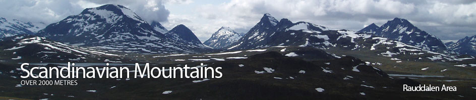
Scandinavian Mountains over 2000 metres - James Baxter
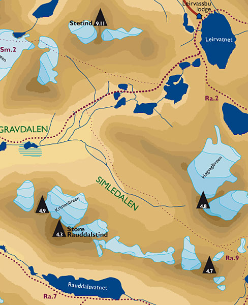
Areas › Rauddalen Area › 4.3 Store Rauddalstind (2157m)
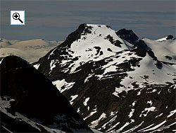
Store Rauddalstind, 2157 metres, It the highest and central point in a narrow 8 km long ridge which lies between Rauddalen and Simledalen valleys. The bare south flank of this ridge is composed of steep slabs and is virtually impenetrable. On the north flank there are some 6 glaciers separated by various ridges. It is via these northern ridges and across the glaciers that the different ascent routes are found. It is feasible to do all three of the Rauddalstind mountains in a single very long day. For a detailed description of this traverse it is necessary to combine the routes from the pertinent saddles on each of the three Rauddalstind pages.
| The Route from Leirvassbu Cabin | |
|---|---|
      |
|
From Leirvassbu follow the locked track, Ra.1, south, then south west, for 6 km past the Gravdalstjørnene lakes and round the looming spur of Høgvaglhøi until you are at the mouth of Simledalen. Here you leave the track, push through the willow scrub to get to the Storutla river. This river is quite large, but slow flowing, in this area and will inevitably have to be waded.
Simledalen Valley
Continue south through scrub and start to make your way up Simledalen valley for 4 km on the route Ra.9. This is a seldom visited area and there are no marked paths here. Cross the Simledøla stream to the south side and pass under the 2 glaciers that come down from Store Rauddalstind. Then head to the west of a small line of cliffs just above the valley floor, and in line with Austre Rauddalstind. Climb up the slope to the west of these cliffs to reach a point ½ km south west of 1615m. You should now be just north of the middle saddle on the long ridge that contains 3 saddles.
 Between this point and the middle saddle the glacier that runs along the entire north side of the ridge has shrunk so much only a thin strip remains and it is easy to cross here to gain the ridge.
The area of glacier between the western most saddle and Simledalen is steeper, wider and more disturbed and although 1½ km shorter is not advised. From the middle saddle head along the broad ridge to over the knoll, 1743m, and to the most westerly saddle.
From this saddle the gradient becomes much steeper as you head up towards Store Rauddalstind. On the south of the ridge there is bare rock and scree and on the north side the is the glacier and a large snowfield. Depending on the snow conditions it is probably best to keep slightly to the south on the rock as you head up towards a dark outcrop marked as 1965m. It is not necessary to climb this outcrop but skirt round its southern flanks to reach a flatter area.
This flatter section ends in a final 40 degree slope that leads to the top. Keep to the east ridge apex here but avoid the cornice and glacier on the north of the ridge. The south east face of the summit pyramid is much steeper. The east ridge is largely composed of stable scree and is quite simple to climb. Once at the top of this ridge the summit is a short distance to the south west across a small glacier which can be avoided by walking along its edge quite easily.
 The Descent

The descent is the same except that it might be possible to use the large snowfield that stretches across most of the ridge below the outcrop marked as 1965m. This snowfield was avoided on the ascent in preference to the more stable rock.
To reach the top of this snowfield just keep south of the outcrop and head east. Do not go to far to the north as this will take you on to the glacier. At the bottom of this snowfield is the most westerly saddle. Cross it and go over the knoll 1743m to the middle saddle where you can cross the glacier to the north and descend back down into Simledalen.
Alternative Descent
If you are combining the ascent of Store Rauddalstind with Austre Rauddalstind do not descend from this saddle but continue east along the ridge to reach point 1930m, then skirt round the top of the glacier on the eastern saddle before the final steeper ascent which involves an easy 3 metre step which can be climbed in the middle. Descent the same way to the middle saddle then head back down into Simledalen.
For more information see the Austre Rauddalstind page. This will add another 2-3 hours onto the time.