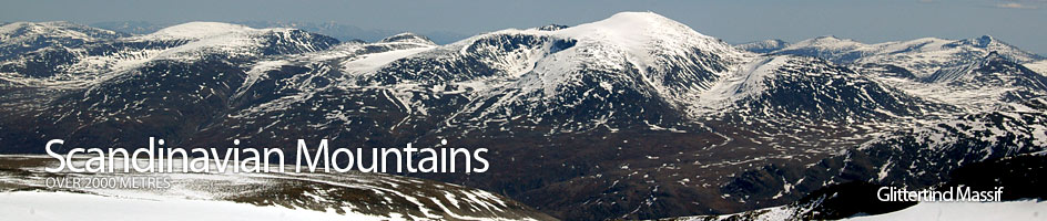
Scandinavian Mountains over 2000 metres - James Baxter
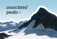
Areas › Glittertind Massif › 13.1 Glittertind (2452m)
Glittertind, 2452m, is the second highest mountain in Norway. However, this height is the solid rock and in addition to this 2452 metres there is another 10 to15 metres of ice which varies marginally in thickness from year to year. If the height of this ice cap exceeds 17 metres then Glittertind is in fact higher than Galdhøpiggen which has no icecap. This was the case for much of the twentieth century, when Glittertind was considered the highest mountain in Norway. In recent years the ice cap on Glittertind is diminishing so it is unlikely that Galdhøpiggen's status will be troubled in the near future, unless a mini ice age returns.
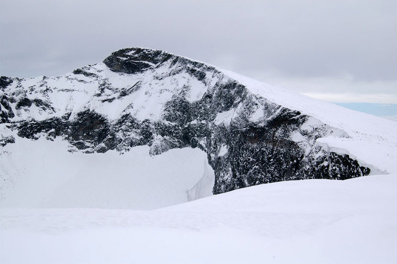
Glittertind is a massive pyramid shaped mountain with a steep north face, rising out of the Grjotbreen glacier, and a large corrie on the south face also. The ridges which run up to the summit on the east and west sides are quite gentle and are the most common ascent routes in both summer and winter. However due to the massive and dangerous cornices which fringe each side of these two gentle ridges the higher reaches of Glittertind are treacherous in poor visibility, especially in the winter/spring.
| The Route from Glitterheim Lodge | |
|---|---|
      |
|
From Glitterheim there is a marked route that leads from the lodge to the edge of the ice cap at an altitude of 2274 metres. This route leads off just to the west of the lodge and heads up the slope 200 metres to the east of the Stienbuelve stream. After 20 minutes the gradient eases as you enter Steinbudalen valley. The route does not enter Steinbudalen but veers north and starts to climb the vast open south east flank of the mountain towards the east ridge. The gradient is not steep but is sustained for 2 hours as you follow the cairns up across alpine vegetation, scree and snowfields.
 The route does not go directly up to the main east ridge but veers north west and climbs diagonally up the south side of this ridge. The views to the south across the deep Steinbudalen valley and its two lakes to the mountain of Ryggjehøe becomes more and more impressive, but the real views do not unfold until you approach the glaciers at the top of the south side of the ridge and can see over Ryggjehøe to the steep and glaciated north-west faces of many mountains in the north west Jotunheimen.
Eventually, the cairned route approaches the shoulder on the ridge, marked as 2274 metres. The route does not go all the way to this shoulder but passes 200 metres to the south of it heading due west and arrives at the last route-marking cairn. From here the route continues west but across the unmarked glacier to gain the glaciated ridge that leads to the summit. If the visibility is poor you should reconsider continuing the final km to the summit, as the cornice on the north side of this ridge overhangs a vast drop.
Once on the glacier to the west of the shoulder 2274m continue due west for a few hundred metres following the icy bulge as it becomes a more pronounced ridge. From here the glacier might be icy in the summer and crampons could be useful, while ice axe should always be carried. At last, the spectacular views also to the north, over the Grjotbreen glacier and the remarkable mountain of Trollsteinseggje begin to unfold. As the ridge becomes more pronounced and the northern views unfold, the unmarked route keeps to the crest of the ice ridge and climbs a little more steeply towards a false summit for ½ km. Along this ½ km icy ridge keep well back from the overhanging cornice to the north.
 From the false summit continue westwards for a similar, but not so steep, ½ km along the crest to the main summit. Along this final stretch one gets a good view of the thick build up of ice on the summit. The summit itself is quite flat but again be vary of venturing to far to the north towards the cornices. The view from here is very extensive, to the south and west is most of Jotunheimen while to the north and east are extensive forests stretching to the horizon punctuated by other mountain ranges like Dovrefjell and Rondane.
The return is by the same route back to Glitterheim. Alternatively, it is possible to descend down to Spiterstulen by reversing the alternative route described above. It is also very feasible to combine the ascent of Glittertind with that of Ryggjehøi by descending down the south west ridge of Glittertind to the saddle, marked 1841m, on the south west of Steinbu-kampen. The route is unmarked and across some steeper scree but is largely unproblematic. However, you should be wary of the cornices and huge drop to the east of this descent. Once at the saddle Ryggjehøi is easily ascended (see the Ryggjehøi page for further details). This saddle is also on route Gl.2 from Glitterheim to Spiterstulen, which can be followed to either lodge should an ascent of Ryggjehøi be abandoned. The ascent of Glittertind and Ryggjehøi and the return to Glitterheim lodge should take about 9 hours in total.