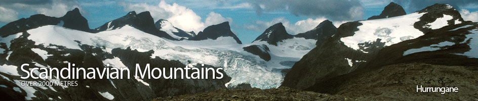
Scandinavian Mountains over 2000 metres - James Baxter
Areas › Hurrungane › 1.2 Styggedalstind (2387m)
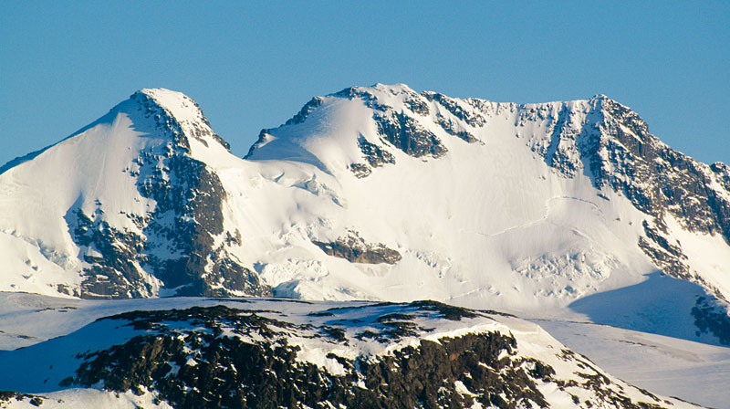
Styggedalstind, 2387m, is the fourth highest mountain in Scandinavia. It dominates the eastern half of the famous view of Hurrungane as seen from Sognefjellshytta lodge and on so many calendars. It comprises two tops, the higher eastern and slightly lower western top which are connected by a horizontal but jagged arête.
| The Route from Skogadalsbøen Lodge | |
|---|---|
      |
|
Climb Gjertvasstind as described on the Gjertvasstind page. From that summit make the difficult descent down the 120 metres to the saddle called Gjertvasskardet, probably across some ice patches. This descent is also described on that page. Once at the saddle you can start to ascend the east ridge of Store Styggedalstind.
 From the saddle continue up the glacier for 15 metres and then cross onto the rock ridge. Be wary of a small bergschrund here. Continue up the rock ridge along the south edge of the glacier.
Initially this rock ridge is moderately steep for 40 metres but the scrambling is easy. Then the ridge steepens considerably for 15 metres and the scrambling is grade III, although if wet it is wise to use rope here.
After this steeper 15 meter section the gradient of the ridge eases considerably but the scrambling continues to be interesting on firm rock, with the odd section at grade II.
Occasionally it might be easier, but not necessary, to venture onto the snow or glacier on the north side to bypass a more difficult section. After a short hours scrambling from the saddle the summit is reached.
The Descent
To return follow the ascent route down to the saddle and then over Gjertvasstind again. In the event of the weather deteriorating badly this is still the preferred escape route.
 The descent down Gjertvassbreen glacier from Gjertvasskardet is riddled with crevasses, initially steep and could be avalanche prone in certain conditions. This glacier descent demands considerable mountaineering expertise.
To continue to west top follow the ridge westwards for a short ½ hour along the sensational arête with the occasional scramble and downclimb, all short but some tricky, especially in the wet.
From the west top it is possible to descend to the saddle between Styggedalstind and Sentraltind by reversing the ascent route described in the alternative section.