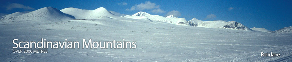
Scandinavian Mountains over 2000 metres - James Baxter
Areas › Rondane › 17.1 Rondslottet (2178m)
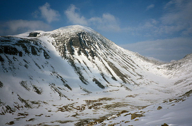
Rondslottet 1278 m, is the huge fortress in the heart of Rondane. It consists of the main summit and another peak, Vinjeronden 2044m, on the south ridge, separated by a small rocky saddle. Although the are virtually no glaciers on this massif now previous glacial periods have carved of four deep corries into the bulk of Rondslottet with huge wall of crumbling sandstone. One of these walls, the north face, is 600 metres high.
| The Route from Turtagrø Hotel | |
|---|---|
      |
|
From Rondvassbu ascend the steep bank to the east immediately upon leaving the lodge and climb for 60m to reach level ground where the start of the Rondholet valley is visible 2 km to the northeast. In spring it will be necessary to go south upon leaving the lodge for ½ km to avoid the steep bank. There is a fairly gentle slope up to the entrance of the Rondholet valley and keeping a bit to the south you will avoid the narrow ravine which can be difficult in spring.
 At the entrance of the Rondholet valley the ground levels out for nearly 2 km as you head northeast to the saddle between Vinjeronden and Storronden on the skyline. At this point the marked path starts to get steep and if you are on a spring tour then skis are best left here if you are returning by this route or strapped to your sack if returning by another route.
Still continuing towards the saddle, 200m have to be climbed in a little over ½ km. Once at the saddle you are rewarded with a birds eye view into Storbotn Valley. From this saddle turn northwest and follow the spine of the ridge for nearly 1 km as you climb up 300m to reach the top of Vinjeronden and the first good view of Rondslottet.
From Vinjeronden the route to Rondslottet follows the obvious ridge north for a slow 1½km. This involves descending 80m over ½ km to the saddle then ascending 200m for the final one km. During this ascent there are a couple of short scrambles. In the summer this ascent should not present any problems but in the winter/spring may be a bit tricky.
 Needless to say the view from the top is amazing, especially towards the Smiubelgen group 6 km to the west across Rondvassdalen, and over to the Jotunheimen where the white giant of Glittertind is easily visible on a clear day. Care is needed if you approach the top of the huge north wall, a further 100m to the north, as it is often heavily corniced in spring.
The descent can be done by retracing you steps. Alternatively, you can descend the northeast ridge if continuing to Bjørnhollia lodge as described above, allowing 9-10 hours for the traverse. It is also possible to descend the northwest ridge if continuing to Dørålseter or returning to Rondvassbu via Rondvatnet lake. In Spring you can ski across the Rondvatnet lake, but in summer you must take the boat, and the last is around 1630, so it is better to go in the other direction as it is a tight deadline and the return over Rondhalsen will take another three hours.
 For the ambitious it is also possible to traverse Rondslottet and Storronden in a day. This is probably best done from Rondvassbu by taking the boat first then ascending the north west ridge of Rondslottet.
From here descend to Vinjeronden and then on down to the saddle with Storronden. Climb the steep ridge from this saddle for 400 vertical metres to the summit and then return as described on the Storronden page.
This traverse should take 10 hours and involves 1500 metres of ascent and descent over a minimum of 15 km.