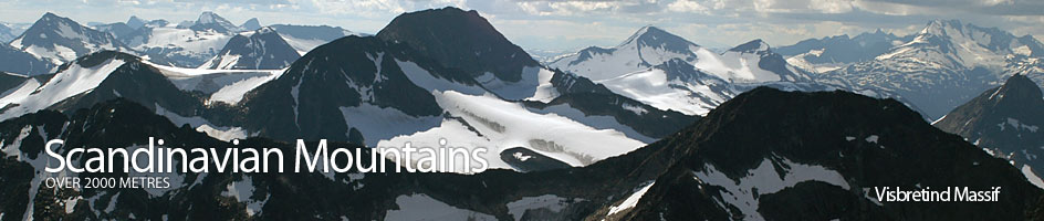
Scandinavian Mountains over 2000 metres - James Baxter
Areas › Visbretind Massif › 5.4 Midtre Urdadalstind (2060m)
Midtre Urdadalstind, 2060m, is the central high point of the magnificent Urdadals ridge. It is the lower of the two mountains along on this ridge; the higher being Store Urdadalstind. It is however equally spectacular and its south ridge, which is a sensational knife edged arête, is from a walkers point of view the highlight of the whole massif. The north ridge connects it with Store Urdadalstind through a craggy saddle. There are no glaciers on Midtre Urdadalstind.
| The Route from Spiterstulen Lodge | |
|---|---|
      |
|
From Spiterstulen lodge follow the path Vi.1 up the east side of the Visa river for 2 hours or 6 km until you get to the marked junction with the path Me.2 which goes south up Urdadalen valley. Take this marked southern fork which goes through this boulder covered valley to Gjendebu lodge.
After an increasingly stony ascent for 1½ hours up this deep valley you approach a slabby saddle, Urdadalsbandet, at about 1685 metres. Just before this watershed leave this marked path and start to climb a stony spur to the west for ¼ hour. When the spur merges into a steep boulder slope bear south across the slope for another ¼ hour, passing under the craggy buttresses at the southern end of Midtre Urdadalstind, until you reach a more gentle slope of firm stones, beyond which is a snowfield.
 Cross the snowfield to gain the main south ridge about a ½ km above a small tarn which lies in the middle of the saddle with Semelholstind.
From Leirvassbu Lodge
It is also possible to reach this saddle from Leirvassbu or Gjendebu lodges. From Leirvassbu lodge head along the path Vi.1 for 1½ hours through Kyrkjeglupen to the watershed in Visdalen.
Continue past the watershed on the marked path for another ¼ hour making the short gradual descent into a grassy bowl on the valley floor. Leave the path here before it crosses the glacial stream flowing from the Visbreen glacier and head east across the tundra soon reaching and easily crossing this same glacial stream. Once over the stream sidle round the bottom of the craggy north ridge of Semelholstind gently climbing stony tundra for a km until you reach another stream coming out of Semelholstjørni lake.
Cross this stream and head up the east side of it where the terrain is less stony to the outflow, some 2½ hours after leaving Leirvassbu lodge. Then follow the rocky east shore of the lake for 1½ km to it southern end then continue south across moraine to towards the foot of a small glacier.
Once at the glacier head east on the apex of a rocky spur. Head up the boulders and occasional bare slab of this spur for ¼ hour until it get steeper. Clamber up the final outcrops for 10 minutes to gain the saddle just to the north of the small tarn. It take about 4 hours to reach this tarn from Leirvassbu lodge.
From Gjendebu Lodge
If coming up from Gjendebu lodge follow the Path Ra.3 for 2½ hours to the junction with Me.2, then follow this path up across pleasant grassy tundra into the mouth of Urdadalen for an hour until you get to the first and lowest of the lakes. Before the lake the terrain become much more stony and this continues as you pass the lower two lakes on their east shore. Just before the third lake at 1618m cross the stream to the west side to reach the base of the south east ridge of Midtre Urdadalstind.
 Climb up this pleasant ridge weaving up across bare rounded outcrops and pleasant flower rich grassy shelves for a enjoyable ½ hour until you get to a large snowfield. Veer west here away from the ridge and ascend this snowfield to gain the saddle some ½ km north east of the tarn. It take about 5 hours to reach this tarn from Gjendebu lodge.
From the tarn initially head north up easy stony slopes to reach the southern end of the arête for 5 minutes. Then follow the lofty arête north for another 5 minutes to reach the minor top of 2017 metres where the excitement starts.
At first there is a reasonably airy 300 metre section to a small notch with a narrow sharp prow rising beyond it. This prow is only some 20 metres long but is somewhat exposed and offers some scrambling at grade II if tackled head on. It is also possible to avoid the prow on either side, but on the west side it is quite loose near the apex of the prow.
After this exposed prow there is another 400 meters of quite exposed and varied scrambling, both up and down, but none of it difficult, over a couple on minor tops until you suddenly reach a deep cleft. This is the crux of the traverse.
The descent down the south face of this cleft is a good 10 metres and there is a open chimney on the east side of the face which is easiest route to downclimb into the dark, damp bottom of the cleft and is difficult grade II. At the bottom of the cleft is a steep gully which twists down the east side. This gully is often full of snow and ice even late in the season.
The top of the gully must be crossed in order to reach the other side of the notch. This is only 2 metres away but if the gully is icy it is dangerous and extreme care must be taken so as not to slip and vanish down the gully. It is only advisable to cross at the very top of the gully. The climb up the north face of the cleft is slightly easier, but is still very steep and is an easy grade III for 10 metres.
Once out of the cleft the is some easy scrambling over a small pinnacle to reach a notch. There is a slab to scramble up on the north side of this notch onto the arête again. This can be tackled straight on or avoided on the east side but this also involves some scrambling.
From the top of the slab there is a further 5 minutes of interesting and quite steep scrambling up the final part of the arête to reach the summit. The whole traverse along the arête from the vicinity of the tarn on the saddle with Semelholstind take a little under an hour.
The Descent
The descent can be by the same route. However, a better alternative is to descend the north ridge which is described in the alternative routes section and then go up Store Urdadalstind and descend via its north ridge, and this is described on the Store Urdadalstind page.
It also possible to descend from the saddle between the two mountains by starting to head down across the boulders from the pinnacles on the north ridge of Midtre Urdadalstind to Semelholstjørni lake; also described on the Store Urdadalstind page. If returning via Store Urdadalstind the total time to return to Spiterstulen lodge is similar.