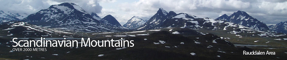
Scandinavian Mountains over 2000 metres - James Baxter
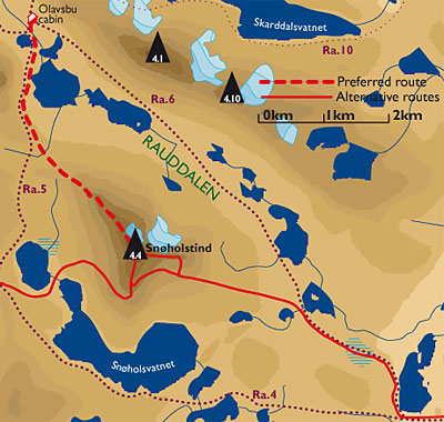
Areas › Rauddalen Area › 4.4 Snøholstind (2141m)
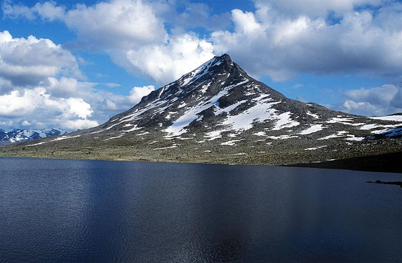
Snøholstind, 2141m, is a massive free standing mountains. Its is surrounded by open U shaped valleys which are dotted with tarns and lakes. The mountain is somewhat triangular in shape with 3 sharp arêtes rising up from the valleys to a small flat summit. Between these 3 arêtes are 3 quite steep faces. There is a small glacier on the northern face.
| The Route from Olavsbu Cabin | |
|---|---|
      |
|
From Olavsbu cabin take the path Ra.5 heading south to Fondsbu lodge for 2 km until you reach the pass between Mjølkedalstind and Snøholstind. This pass is the start of the north west ridge. From here go directly up the ridge across gentle plates of bare rock that been exposed by glaciers and cracked by ice.
 These plates eventually give way to steeper ground of mixed rock and vegetation and then slightly steeper ground of scree. This scree leads up to the first crag that needs to be negotiated.
This first crag is a 40m step which is easily passed on the south side where cairns mark an obvious route through loose scree and a rocky nose to gain a flatter part again. This is not a difficult is a bit loose.
The Arête
From the top of this nose the arête is quite wide and easily followed up a shallow gradient to the next obstacle. Here the arête steepens considerably and becomes much narrower.
 Initially the route is straight up the centre of the arête for 20m but then veers of to the north side along an upward shelve for a further 30m.
The route then turns straight up the north side for a further 20m which brings you to a small flat table at the top of this interesting section. There is a cairn here but it might also be worthwhile to make a mental note of the terrain to locate to spot for the descent.
The arête now is slightly narrower than previously but is not particularly exposed and continues to ascend gently for a further 300m until it reaches the third and final obstacle, this is a sharp 6m step which presents and interesting scramble onto a short but airy 10m spine before the main wider arête is joined again.
This step and spine can also be avoided by going around the north or south side and scrambling onto the main arête once past the spine.
 Once past this third obstacle the arête broadens considerably and it is plain sailing for the remaining ½ km to the top and the summit cairn. Needless to say the view from here is stunning, not least of the sharp northwest arête you have just ascended which looks very lofty from above.
The Descent
The descent is by the same route back to Olavsbu cabin. It is also feasible to descend the west flank to Fondsbu lodge allowing 7-9 hours or the east flank to Gjendebu lodge allowing 8-10 hours.
For details on these other descents reverse the alternative routes. Both of these descent routes involve steep snow or some scrambling and are only suitable for more experienced parties as descent routes only.