Scandinavian Mountains over 2000 metres - James Baxter
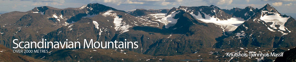
Areas › Knutshols Tjønnhols Massif › 8.2 Tjønnholstind (2331m)
Tjønnholstind is a lies is the barely visited tract of mountains between the Lakes of Gjende and Bygdin and is the second highest peak in this area. Tjønnholstind is the highest point at the western end of a 4 km ridge which has been carved out of the massif by 5 glaciers. One of these glaciers the Nørdre Tjønnholet glacier has carved out a huge and foreboding bowel on the north side of Tjønnholstind and left a dark 400m face below the summit. The arête between east and west (store) Tjønnholstind is very exposed to this north face and offers some trick problems including a small overhang. For this reason it is best avoided and a traverse across the 40 degree south-east face is the preferred route. However, because of the avalanche danger on this convex south-east slope it cannot be recommended as a spring ascent.
| The Route from Gjendesheim Lodge | |
|---|---|
      |
|
From Gjendesheim the river Sjoa can be crossed by rowing boat by appointment with Gjendesheim staff. From here head south round the west flank of Gjendehøe to the cabins at Leirungsbuin. Continue south across marshy ground round the west side of the lake and then ascend into the forest by the Varga stream. Climb up through the forest for ½ km until the path crosses a bridge in a rocky ravine. This is about 1 hour from Gjendesheim assuming no waiting for the boat. If starting from the parking place on the N51 then head due west on the path for ½ km until you get to the same bridge.
From the bridge over the Varga stream the path continues westwards between the forest on the steep slopes of Knotshøe and a cabin for a further 1 ½ km until it then turns south-west and descends down the ½ km to the bridge over the River Lierungsåe. The well marked path now climbs slightly and skirts round the eastern side of Semelhøe before turning west and meeting the Steinflybekken stream. The path follows this stream for ½ km before crossing onto its south and continuing round into Lierungsdalen valley. At this point we leave the path.
Continue up the north side of the Steinflybekken stream. There are some barely perceptible animal paths through the scrub. These paths become more visible after a further 1 km when the scrub is passed. The route now steepens and continues up the ridge on the north side of the stream to an obvious funnel. Once past the scree of the funnel the going becomes much more pleasant across the soft plateau of Stienflye. Soon the plateau comes to an end and the route follows a small glacier, then scree to reach a point just north of knoll 1836.
From knoll 1836 the easiest route is across further scree for 1 km until you reach the terminus of Steinflybreen glacier. This glacier has no crevasses and is safe to follow in a westward direction toward the point where the southern moraine ridge of the glacier meets the east ridge descending down from Tjønnholstind. There is a small knoll at this point. The obvious route up the east ridge leads to the east top and the arête from here to the main top requires climbing, so is avoided.
The route now traverses the scree covered slopes of the south-east face ascending slightly as the traverse is made. From the small knoll at the bottom of the east ridge some vertical sections can be seen on the south ridge. Head for the bottom of these. The route is tedious especially in new snow. Once this slow 1 km traverse is completed a steep drop to Søre Tjønnholet appears. From here scramble up the scree and solid rock for 80 metres of ascent until you reach the gentle west shoulder. There is an obvious sloping shelf on the left hand of the south ridge but if it is missed there are other various routes (all will require care and attention as a slip here will have drastic consequences).
Alternatively instead of following the above traverse to the bottom of the cliffs on the south ridge it is also possible to ascend via a sloping ledge above the cliffs to gain the west shoulder. The ledge reaches the west shoulder between the top of the cliffs in the south ridge and the summit itself (nearer the summit itself). This higher and more direct route is more suitable if there is no snow on the the upper parts of the south-east face as it involves a steeper traverse and a greater exposure to avalanche dangers.
Once on the west shoulder the going is easy up to the top. The effort will be made all the easier by the fantastic views that have now opened up in every direction especially to the newly appeared north where the whole of Jotunheimen stretched beyond the green waters of Gjende Lake.
The return route is the ascent in reverse. But beware that the rowing boat to take you across the Sjoa river at Gjendesheim is not 24 hours so make an arrangement before you leave or it might be a further 3 km to walk to the bridge on the main road.