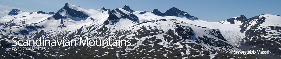
Scandinavian Mountains over 2000 metres - James Baxter
Areas › Smørstabb Massif › 9.1 Storebjørn (2222m)
Storebjørn, 2222m, is a renowned landmark in Jotunheimen. It is a classic mountain whose magnificent profile is well known in Norway. The mountain resembles a bear, with the two bulging summits looking like the bears ears, hence the name "Big bear". Not only is Storebjørn a famous mountain but is it also a superb ascent with a number of interesting obstacles to overcome. Storebjørn is the highest mountain in the massif and the southern point of a convoluted and alpine series of connected ridges. The traverse of these ridges from Kalven to Store Smørstabbtind is a considerable undertaking and although a classic involves some summer grade IV climbing and is beyond the scope of this book but warrants further investigation to experienced mountaineers.
| The Route from Leirvassbu Cabin | |
|---|---|
      |
|
From Leirvassbu drive down the road to a parking place to the west of the knoll Presten, 1511m, on the map. Park here and head west across the river, which could be difficult to cross after wet weather. A path goes round the north side of the small tarn at ref 586256 and then continues across the open flat area of Storflyi. At the end of this section the path descends slightly into a small valley then skirts round a ridge descending north from Steet, before meeting the Tverrbyttbekken stream. Follow this stream up for about a km until a series of shallow tarns are met. Cross the stream at these tarns. Again this might not be easy after wet or weather. Once over the stream head almost due west towards Bjørneskardet pass. Initially the route is pleasant across a mixture of vegetation and shallow slabs but after a km this gives way to moraine for another km. Eventually the edge of the glacier should be met at an altitude of about 1700m.
 This glacier, the Bjørnebreen, has numerous large crevasses. During spring many of the crevasses are covered by extensive snow, giving an illusion of safety. During the summer this snow melts exposing the large crevasses. In late summer most of the snow has disappeared from the lower half and the crevasses and firn bridges are fully exposed while the upper half still has partial snow cover. The route goes up this glacier initially westwards for 600m. Across this section there are some large crevasses. Then the route curves southwest then south for another 600m and climbs more steeply.
The crevasses across this section are not as frequent but are larger. Do not stray too far to the east here, that is near the bottom of the summit ramp as the glacier here is very fissured and travel is both difficult and hazardous. After these 600m the glacier approaches the ridge between Storebjørn and Veslebjørn at the lower or most southerly of the two shallow saddles. Do not go right up to the saddle but veer south east to the middle of the summit ramp and then ascend up to the east of a large tower on the arête on the west side of this glaciated summit ramp. The way in the spring is often blocked, and in the summer nearly always blocked, by a bergschrund at this point and it is necessary to pass it by going onto this large tower. The obvious line from the lower edge of this bergschrund leads one to a point half way up the north east side of this tower.
Head along the lower edge of this bergschrund towards the tower on the arête. As the glacier meets the tower be especially attentive to possible other crevasses. During the early summer season there is usually a snowfield on the east face of this tower which can be traversed to bypass the bergschrund to the west. However, as the summer progresses this melts and it is necessary to scramble from the glacier onto the north side of the tower itself, which is best gained half way up the north side. The upper half of the north side of the tower is a short messy scramble for 7-10 metres onto a large shallow rutted slab which is easily followed for 25 metres along the apex to the top of the tower. From the top of the tower it is an easy 5 metre descent to the glacier again having by passed the bergschrund.
It is also very feasible to continue up to the saddle between Storebjørn and Veslebjørn and then follow the ridge along to the north end of the tower on the arête up to Storebjørn. At the bottom of the north side of the tower there is an extra 10 metres to scramble up to get to the point half way up referred to above leaving the short messy 7-10 metre scramble to gain the shallow slab. The lower 10 metres of this north edge are also messy with loose scree but is still a moderate scramble. In the early summer much of these 10 metres will be covered in a small by steep snowfield making the above alternative up to and along the bergschrund more attractive.
After regaining the glacier at the south end of the tower, the edge of the glacier is easily followed beside the arête for 100m until the gradient becomes considerably steeper. Here there is a short section of about 70 metres which is up to 40 degrees. Later in the summer this could be slightly icy. This steepness of this section could be reduced by making a traverse out to the centre of the glacier then back again. However, this traverse might entail going into a crevassed area. The arête during this section could be followed but is a difficult scramble and the glacier although steep is preferred. From the top of this steeper section it is a further easy 100m to the summit on the western of the two "ears".
The descent is by the same route. However, it would be best to combine an ascent of Storebjørn with Veslebjørn. To do this descend to the bottom of the tower and then continue down the arête to the southern saddle. From this saddle ascend and descend over a shallow rise in the connecting ridge to reach the northern saddle. From this northern saddle the south ridge of Veslebjørn can be followed to the top. This northern saddle is can also be used as a descent route to Smørstabbbreen glacier, down the gully on the west side. Smørstabbbreen can then be followed to Krossbu lodge as briefly described above.