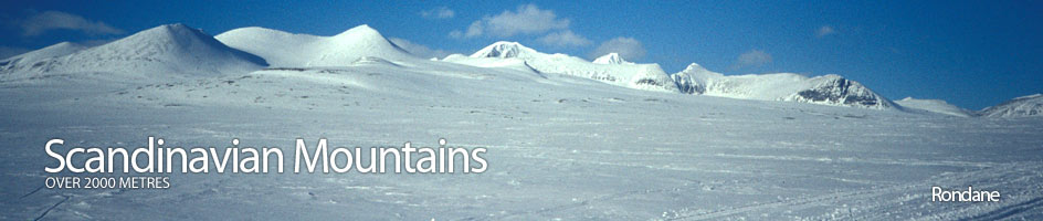
Scandinavian Mountains over 2000 metres - James Baxter
Areas › Rondane › Sagtind › Alternative Routes
Sagtind is best ascended from Rondvassbu. During the high season, around Easter and the high summer, the whole lodge is open. During the rest of the year there is a self service cabin available, for which a DNT key is needed to open. For access to Rondvassbu Lodge see the general Rondane section. The best ascent route up Sagtind is via the north ridge from the north end of the lake marked 1470m. This Lake can be accessed from either Rondvassbu as described below in detail or from Dørålseter, as described briefly immediately below. From either lodge it is about 3½ hours to this lake along the marked path which goes from one lodge to the other.
 Leave Dørålseter on the path to Rondvassbu marked track. After about 800m the path divides and you want to take the southern branch which soon crosses the Dørål river. Continue beside the river for another 800 metres under a steep terrace until you reach a smaller stream the Bergedalsbekken flowing from the south. Whilst walking beside the river under the terrace you have been passing under Skranglehaugan, a remarkable moraine landscape with numerous depressions formed by the melting of isolated glacial ice. It is well worth making a detour up the terrace to view this landscape.
Once over the Bergedalsbekken stream continue on the path for another 1200 metres until it divides. One branch goes south up Bergedalen valley while the other continues south west up the Dørål valley. Take the latter marked path and follow it up the Dørål valley for five km. After following the path for five km up the valley the path veers south and begins to climb up a side valley which is quite deep. Follow the path for one km up the east side of this deep valley until the valley starts to flatten out. When the valley starts to flatten out leave the marked path and cross the small stream onto the west side and head south for another km across easy, well-packed, small moraine to reach the small lake marked as 1450 metres. Keep just to the east of the small knoll 1482 metres. Go round to the west end of the lake where the north ridge of Sagtind starts. Climb this north ridge as detailed below in the detailed route description.
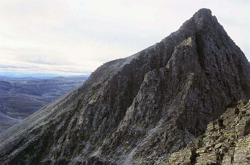
 The most obvious route to ascend Sagtind is via the col between Steet and Storsmeden and then the south arête. However, this route is plagued by loose rock and the direct line up the arête needs climbing skills up to grade IV, but because of the poor rock quality is considered dangerous. I have still described an alternative to this arête which avoids the climbing section by traversing it on the west side. From the saddle between Storsmeden and Steet, which apparently is difficult and dangerous to access in the winter due to a double cornice, climb the 130 metres to the top of the knoll at about 1883 metres, which lies directly to the west. From the top of this knoll descend down about 80 metres to the north to a saddle which marks the start of the south arête of Sagtind. From the saddle there is a steep section which is best tackled on the east side initially bypassing a crag to gain the arête.
This arête is then enjoyably followed up to a top marked as 1897m. After this top the arête becomes far more broken. Follow the arête down to the next saddle but then instead of ascending the next top via the arêtes apex it is preferable to drop down the west side from the saddle. Here there is a series of ledges which slowly descend to the west. This series of ledges cross a few gullies full of loose scree and passes under the large unstable pillar and crag that are the advised against direct line.
As these ledges descend for about 300 metres horizontally from the saddle they slope down to an elevation of 1750 metres, where they meet a couple of buttresses. The first of these buttress, just after a steep gully with an overhanging crag in it, is quite loose but the second is more stable. Once on the second buttress start to head up the spur and then start to traverse south across the steep west face. This west face is largely composed of loose boulders and plates of loose rock and it is quite arduous to ascend the 250 vertical metres up to the ridge, which can be done as a rising traverse. Once the main ridge is gained again, which is now no longer an arête, it can be followed south to the main top.