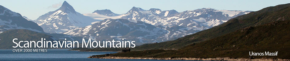
Scandinavian Mountains over 2000 metres - James Baxter
Areas › Uranos Massif › Walking Routes › Ur.1
| Ur.1 | Fondsbu Lodge to Skogadalsbøen Lodge via Øvre Mjølkedalen Valley |
|---|---|
| 8 hours / 24km 530m |
Marked in the summer with cairns. Unmarked in the winter. |
Leave Fondsbu lodge and head north for ½km on the gravel road crossing the Mjølkedøla river on a bridge. Just after the bridge leave the road and start heading up the road on the east of the river into the cabins. Follow this for ½ km until the road ends and a marked path starts 100 metres east of the river.
The path now climbs up, initially through willow scrub, for a km until it veers north and away from the river and up a side valley climbing up onto a small ridge. Here a marvellous view unfolds straight over Mjølkedalsvatnet lake and up Mjølkedalsbreen glacier into the heart of a wild icy massif.
Continue north round the east shore of this spectacular lake into the obvious valley between the steep mountains of Storegut and Høgbrothøgdi. After going up this valley for a km you pass a small tarn and a marshy area before starting a short ascent up to a saddle. 10 minutes after the marshy area and ½ way up to the saddle the path forks.
Take the north west fork (the north fork goes to Olavsbu cabin), skirt round the side of the hill for 100 metres when another spectacular view unfolds. This time down the U-shaped glacial valley of Øvre Mjølkedalen which is strewn with a series of lakes. Sidle across the turf/stone slope to the uppermost lake at the entrance to the valley. Follow the rocky north shore of this lake to the outflow then cross pleasant grassy area, passing a tarn before you cross over the stream to the west side of the valley before coming to a larger lake.
The steep slopes of the majestic Mjølkedalstind rise steeply to the east of this lake. Continue to the north end of the lake where there is another pleasant grassy plain and a great view down Skogadalen valley unfolds. A km after the end of the larger lake the path from Olavsbu cabin joins from the north a steep descent down the valley side.
From this junction continue west down the lazy pleasant valley for 4 km on the south a series of idyllic tarns on the valley floor until you reach a lip. Descend down this 100 metres drop into a basin of willow scrub and the upper limits of the birch forest. Once in the basin enter the lush flower-filled forest and head down the valley for 5 km with the proud Gjertvasstind as a backdrop.
Just before Skogadalsbøen lodge the marked path crosses a large bridge over to the north side of the Skogadøla river.