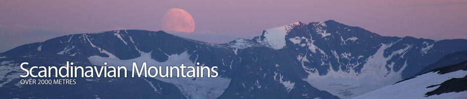
Scandinavian Mountains over 2000 metres - James Baxter
Introduction › Geography & Geology
The Scandinavian Mountains are largely composed of very old rock formed some 400 million years ago when the Caledonian mountain range was thrust up. The enormous mountains created at this time were much higher than anything today but were completly levelled over some 100 million years into a flat plate
This plateau remained from about 300 million years ago to 50 million years ago when there was more movement and the west side of the Scandinavian plate was heaved up just off the coast of Norway, while the east side of Sweden remained lower. The whole plate was therefore at an angle, with the west side much higher than the east and all the rivers consequently flowing east.
This higher west side runs the whole length of Scandinavian. In the south it runs up the west side of Norway, and in the north it runs up the mountainous border between the Norway and Sweden. This chain is also referred to as Kjølen, The Keel, because it looks like the keel of an upturned boat.
All the Scandinavian Mountains over 2000 metres are found along this Keel, although some like Rondane are on the very edge of it. Where the Kjølen it as its most mighty is Jotunheimen and this is the highest and grandest of all mountain ranges in Scandinavia, and arguably the most spectacular.
Jotunheimen
One hundred and one of the 137 mountains over 2000m in Scandinavia are found in the Jotunheimen, which can be divided into 14 separate areas or massifs.One of these 14 regions, Hurrungane, lies on the very western periphery of Jotunheimen, separated from the main area by the huge glacier-carved canyon of Utladalen. Hurrungane is the most alpine of all the 14 regions. Indeed it is probably the most alpine region in Scandinavia, and certainly the most alpine of all the regions where the mountains exceed 2000m.
Ice Ages
Since this tilting of the plate some 50 million years ago there have been numerous ice ages which have eroded it, particularly the western higher side. In the last 2.5 million years it is estimated there have been some 40 different ice ages alone. These ice ages have been the main shapers of the landscape we see today as the glaciers which came and went scraped away corries and valleys, often leaving the higher peaks protruding through the ice.
The last of these ice ages was from 50,000 years ago to 10,000 years ago, and this pretty much obliterated all evidence from the previous ice ages. There have been some minor ice ages since then, and even as recently as the mid 18th century there was a mini ice age when glaciers surged forward again, enveloping farms and fields. The scars from this age are still visible, as lichens are still recolonizing the recently exposed surfaces.
Rock Varieties
Geologically Jotunheimen is a distinct region composed of gabbro or gabbrogneiss rock varieties. The former is a very hard rough rock usually black with white flecks, and the latter is even harder and usually white with black flecks in parallel stripes.
To the northwest lies the neighbouring Breheimen region which is largely composed of gneiss and to the east lies the neighbouring Rondane region composed of sparagmite, a softer sedimentary sandstone.
The gabbros of Jotunheimen, and especially Hurrungane, are a very hard resistant type. Despite seeing far greater glacial activity than areas further east (due to the greater precipitation on the western ranges) the hard rocks in Jotunheimen, and especially Hurrungane, have been stubborn in resisting glacial erosion. This has encouraged high angular peaks, often formed as the tops of these mountains pierced through the various ice sheets as nunataks. These high peaks are supported by arêtes formed by the glaciers scouring the sides of ridges until they narrow into sharp jagged buttresses.
Primary Glaciers
Once the ice has scoured the ridges and corries it flows into primary glaciers, taking with it the debris which it has ripped from the rock and which has fallen onto it from the frost shattered summits above. These primary glaciers are an abrasive river of ice scouring out the sides and especially the floors of the valleys, making them U shaped. These primary glaciers are now largely melted but remnants like Maradalsbreen in Hurrungane and Rabots glacier in Kebnekaise remain.
Secondary Glaciers
During the ice ages these primary glaciers would have flowed relentlessly down until they reached the much bigger secondary glaciers. These secondary glaciers would have flowed towards the sea, creating vast steep-sided valleys as they ripped their way into the earth's surface.
Utladalen and Fortunsdalen in the west of Jotunheimen or Rapadalen in Sarek are prime examples of where these secondary glaciers once flowed. When the earth warmed up these massive secondary glaciers melted and the higher primary ones that fed them were left isolated in hanging valleys. The meltwater from the remains of the primary glaciers often plunge down the steep sides of the canyons formed by the secondary glaciers in spectacular waterfalls.
Once the ice had disappeared from the canyons the rising sea filled the void and created the fjords of today. The parts of these canyons where the floor was above sea level, like Utladalen, were not flooded. They are testament to the awesome power of the melting ice and lie waiting for the next ice age to commence. Then the hanging valleys will again fill with ice and flow into these secondary larger valleys which in turn will fill with abrasive ice and flow seaward, pushing the water out of the fjords again.