Scandinavian Mountains over 2000 metres - James Baxter
Areas › Breheimen › 15.14 Brenibba (2018m)
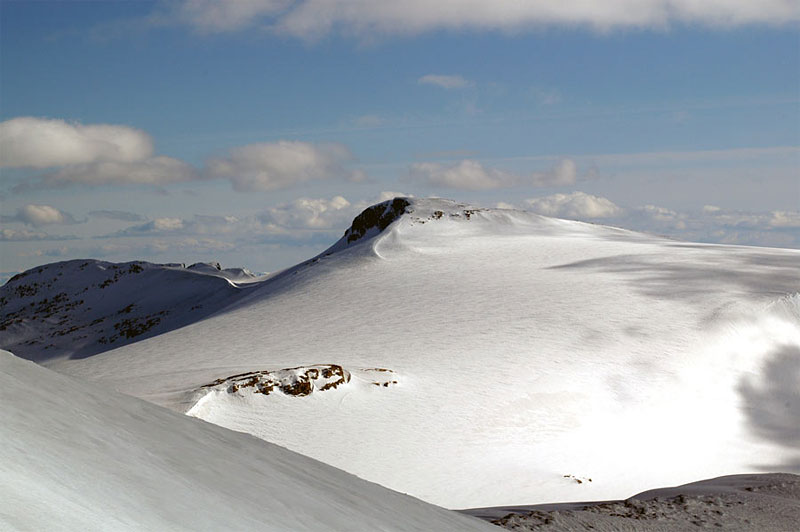
Brenibba, 2018m is a small rounded nunatak protruding from the northern end Jostedalsbreen ice sheet, just to the south of its much more famous neighbour Lodalskåpa. Brenibba is completely surrounded by this ice sheet and this of course very much effects its character. To the west it emerges out of a smooth ocean of ice while to the east the cracked glacier ice flows steeply down towards Jostedalen valley.
| The Route from Bødalsæter Cabin | |
|---|---|
      |
|
The route up Brenibba follows the same as route up Lodalskåpa as far as the top of Brattebakken. I am repeating here in the first four paragraphs. Leave Bødalsæter and head south west for 400m to reach the bridge over the icy Bødalselva river. Once over head upstream on the west bank for two km on a good path through birch forest until you get to a concrete bridge over the glacial stream from Bødalsbreen glacier. After the bridge the path continues along the south of the river for another gentle km, crossing a smaller bridge, before it starts to climb towards the small waterfall riddled cliff, called Fessene. During the km climb the path is much more rugged and in some place quite steep as it weaves up through the birches, immediately to the south of the main waterfall, and to the north of another stream. At the top of the Fessene cliff the path emerges from the remaining birch onto a flat valley floor.
 Continue west into the valley on a clear path between the two streams. Ahead the valley curves round to the south into a steep glacier rimmed bowl. As the valley swings south a long mixed stone and grass slope rises out of the valley floor 1½ km straight ahead in the east. This is Brattebakken, a relentless 700 metre ascent right up to the edge of Bohrsbreen glacier. Follow the path along the pleasant valley to the bottom of Brattebakken and start to climb.
The path becomes much rougher and less pronounced as it climbs steeply. After climbing for an hour the path veers south passing to the south of the knoll 1331m. If you divert briefly to the knoll you will have a glorious first view of Lodalskåpa. From the knoll the path continues to climb steeply for another hour. The glaciated bowl to the south becomes more spectacular as you climb. At the top of the second half of the climb there will often be snowfields and this can make the arduous ascent even harder. Not before time the gradient at last starts to ease as the top of the climb is reached. As you approach the top veer east to gain a rock outcrop. On top of this outcrop is a large cairn. It is important to locate this cairn on the return as it marks the top of Brattebakken and the descent route.
During the winter and spring the snow up the first section of Brattebakken is steep and occasionally avalanche prone. To avoid this danger and enjoy a more pleasant ascent do not go straight up Brattebakken. Instead veer north east and follow the southern bank of the stream which tumbles down from Kåpevatnet lake. There is no path but it is easy to pick a route through the crags, along as you do not stray too far onto the ridge to the south. After a km the river from Kåpevatnet emerges form a broad shallow gully. Enter this gully which, should be entirely snow-filled, and it will lead you up to the outflow of the lake. The last 20 metres may be steep. Once at the lake there is a gentle climb up to knoll 1331m. Do not go to the knoll, but pass 200 m to its east while going south and still climbing and then enter Brattebakken higher up leaving you with only the final 200 metres to climb.
 At the top of Brattebakken and the cairn you arrive at the edge of Bohrsbreen glacier. While this is considered a safe glacier there are some crevasses and deep ravines from surface streams and in the summer time a rope is essential. From the cairn head south for two km across the glacier. After a few hundred metres the glacier levels off and the view towards Ståleskardet, Brenibba and knoll 1872 metres appears. Head for knoll 1872 metres which is a km to the west of Brenibba itself.
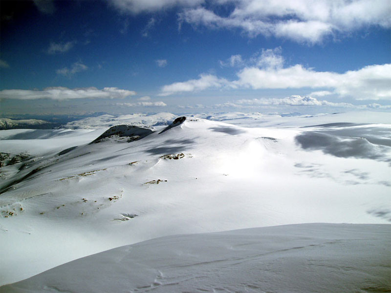
After a km you will pass the saddle of Ståleskardet and its steep wind carved ice cliffs which are heavily corniced in the spring and should be avoided, especially in poor visibility. From Ståleskardet there is a very gentle rise for another km south towards knoll 1782 m to reach the bottom of a steeper slope. Climb this slope, easily zig zagging on skis in spring or straight up in summer for a easy short ½ hour to gain the west ridge. As you approach the ridge veer east and then continue up the ridge for an easy km to reach the summit. Along this final section there are fantastic views over the ice fall of Småttene to the majestic Lodalskåpa to the north.