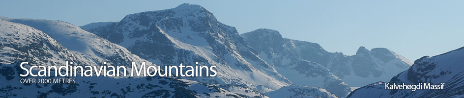
Scandinavian Mountains over 2000 metres - James Baxter
Areas › Kalvehøgdi Massif › Rasletind › Alternative Routes
 There are two routes up Rasletind from two different starting points, namely Valdresflya Vandrerhjem hostel and Bygdin Fjellhotel lodge. The former is much shorter, easier and this route is described on the main route page. The later route is longer but is a better option in the spring when there is road or weasel snow tractor access to Bygdin is open but the route over Valdresflye is still blocked. This route is described here. It is quite feasible to make round trip starting at one and finishing at the other in spring on skis after the road has opened around mid April or on foot in the summer.
From Bygdin Fjellhotel lodge
From Bygdin Fjellhotel lodge it is possible to to go east round Synshorn to the south end of Rjupetjernet lake. Head up the west side of the lake until you approach the end and then climb west into the small Øystre Fagerdalen valley. Follow the north shore of the lake and cross over a small saddle. As you descend on the other side towards the damp and scrub covered valley you meet the path Ka.3. and just after it Ka.2. Cross them both and then jump the stream where the Øystre Repefonnbekken beck joins the stream. This is essentially only a route to consider in the winter/spring on skis when the lakes and marshes crossed are frozen.
Alternatively go along the locked track for 3 km on path Ka.1 until you get to the semi derelict Bygdisheim lodge on the north shore of the lake. Just beyond this ramshackle building leave the path Ka.1 and head north traversing up the gentle hillside on path Ka.3 for another 3 km. Leave the path here and head across the flat valley floor keeping well north of the small tarn with the island. The terrain here is marshy with the odd willow thicket to bash through. In the winter/spring however it is easy to cross this valley. Make for the ridge between the two valleys containing the Repefonnbekken becks.
From one of the two above variations you should now be near the bottom of the slope and then ridge which goes up between the two Repefonnbekken becks. Jump the Breidløypa stream and bash through a few thickets to bottom of the slope and then start to ascend it. In the summer it is probably best to keep between the streams as the fledgling ridge forms and then follow this up its broad stony crest. In the winter/spring it is probably best to keep slightly to the north east of the ridge as the crest is sometimes sparsely covered. Whichever way is most suitable you eventually come to the the knoll at 1844 metres which lies on the edge of the enormous stone covered plateau of Raslet. On the north east the massive bulk of Rasletind drops straight down to a lake fringed with snowdrift.
Head directly north keeping to the east side of a very shallow bowl filled with looser boulders. After an easy ½ hours climb the terrain starts to level off as you reach a plateau which lies on the 7 km long east west orientated Kalvehøgdi Massif escarpment. Head north east up this stony plateau across easy stable terrain for a km as you approach the final summit dome. The views slowly start to unfold to the north here as you climb but are soon revealed as you climb the final slopes to the summit.
The return is by the same route. Alternatively is is perhaps better to continues down the main ascent route to the peak of Østre Rasletind and then continue down the ascent route from there to Valdresflye. Alternatively it is also possible to return back to the knoll at 1844 metres and the snowdrift fringed lake. Once here head east across the open stony, but pleasant expanses of Raslet for 2 km. Then head down into the more rocky Steindalen keeping to the ridge on its east side until you intersect the main ascent route. Follow this east to Valdresflye passing to the south of the Fisketjørni tarns.