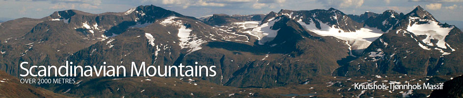
Scandinavian Mountains over 2000 metres - James Baxter
Areas › Knutshols Tjønnhols Massif › Austre Leirungstind › Alternative Routes
Austre Leirungstind is most easily climbed from Leirungsdalen starting at the two Leirungstjønnin lakes. This is the route which I have described below taking Torfinnsbu to be the starting point.
It is also possible to ascend Austre Leirungstind from the Riksveg 51 to the east, but this involves a prohibitively long days march up and down Leirungsdalen valley. It would be better to camp at Nedre Leirungstjønnin lake, 1578m, where there are some excellent campsites on the north side of the lake. From a camp here it would be possible to ascend a number of mountains and peaks in the vicinity.
To reach this camp site either ascend Leirungsdalen from the Riksveg 51 between Valdresflya and Maurvangen and follow the unmarked path K-T.1. (as described in the introduction to this massif) to the lake (4-6 hrs). Or come up from Torfinnsbu Lodge on the path K-T.2. as described there also, you meet K-T.1. which is then followed steeply up to Svartdalsbandet and down to the lake (4 hrs).
 From this recommended campsite it is viable to ascend Austre Leirungstind from the east. This will initially involve ascending Tjønnholsoksle, so please refer to that page for ascent information. From the summit of Tjønnholsoksle descend the large stable scree on the north west ridge keeping to the western edge.
Upon reaching the southern end of the Skarvflybrean glacier head west across it initially over a south facing bowl and then up the steepening slopes towards the saddle to the north of the high crags of Skarvflyløyfttind until you reach the edge of the glacier.
This section of the glacier does not contain any crevasses but is likely to be icy. From the edge of the glacier climb over large boulders for 15 minutes to reach the saddle. It is easiest to keep to the north of the saddle on the ascent to it.
From the saddle follow the broken ridge south for a couple of hundred metres until the ridge steepens considerably. Scramble up this section keeping slightly to the west to avoid the steepest bits. From the top of this steep scramble the gradient levels off and it is easy to follow the stable scree a short distance to the top of Skarvflyløyfttind.
From the summit of Skarvflyløyfttind head west for a km across a plateau covered in stable scree. The plateau then narrows into a interesting arête for ½ km with a few passages of easy scrambling. At the west end of this arête there a final 50 metres of slabs at about 40 degrees to ascend to reach the summit. These final slabs are facing north and may be icy long into the summer.
The descent is by reversing the route given below. The ambitious may also consider continuing the traverse to the west to the saddle with Vestre Leirungstind. The descent to the saddle involves some steep scrambling, one section on slightly loose rock. From the saddle descend the glacier to the south which has occasional crevasses, but still needs glacial experience and equipment. It is possible ascend Vestre Leirungstind from here, up its east ridge, but this involves a pitch of grade IV.