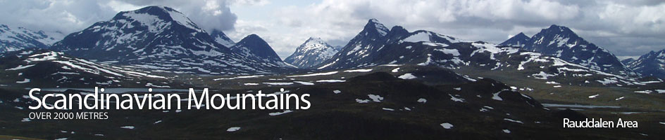
Scandinavian Mountains over 2000 metres - James Baxter
Areas › Rauddalen Area › Walking Routes › Ra.7
| Ra.7 | Skogadalsbøen lodge to Olavsbu cabin via Rauddalen |
|---|---|
| 6 hours / 19km 650m |
Marked path in the summer and in the winter a ski route marked with twigs. |
There are two routes from Skogadalsbøen lodge to Olavsbu cabin: one via Rauddalen and one via Skogadalen. The route via Rauddalen is the usual route and is the winter route, but in good weather the Skogadalen route is more scenic. I describe this second route as an alternative at the end of this section.
Leave Skogadalsbøen lodge and take the prominent marked path through the lush and damp woods. After 2 km there is a major junction with a fork descending down to a large old bridge across the wide Utla river. Don't take this fork but continue north up the east side of the river passing some summer farms at Lusahaugane after a km.
The marked path bears east here up Storutledalen valley, the larger branch of the huge Utledalen valley. Soon the forest thins as you head up this deepening valley on the steep south side of the river but a km after the summer cabins the valley opens out again and the path now heads up on the south bank of the now lazy river as it meanders across a grassy meadow.
Follow this grassy meadow up for 4 km on the south side of the river crossing occasional small streams watering some willow scrub thickets. Eventually the path reaches a junction by a larger bridge. There is a fork which goes over the bridge and continues up the valley on Ra.1 for another 12 km to Leirvassbu lodge. Don't cross the bridge but continue up the south side of the valley for another 2 km towards the imposing west ridge of Vestre Rauddalstind when the path starts to climb more steeply into the lower end of Rauddalen valley. This km into the valley take you from the grassy meadows up to more tundra like terrain.
Once you have ascended the slope into the mouth of the valley the marked path heads up the flatter terrain beside a series on tarns on the valley floor under the imposing south face of Rauddalstind. The view ahead is dominated by the towering alpine mountains of Rauddalseggi and Mjølkedalstind. Follow the path along the south side of the tarns for 3 km until you reach the outlet of Rauddalsvatnet lake.
The remote lake is fringed with stony tundra. Skirt the south shore of the lake for 2 km until the alternative route via Skogadalen valley joins after descending the steep slope from the south. After this junction there is another km to the end of the lake. Thereafter the marked path continues up the south side of the stream across much damper tundra crossed by many small rivulets fringed with verdant moss descending from snowfields on Mjølkedalstind above. 4 km from the lake across this damper tundra the path reaches the bridge over the stream and Olavsbu cabin just beyond.
Alternative High Level Route
If you take the alternative high level route from Skogadalsbøen lodge to Olavsbu cabin start by heading up Skogadalen after crossing the large bridge over the Skogadøla river. Follow the path Ur.1up the south side of the idyllic river through verdant birch woods for 5 km until the woods thin in a bowl. Climb out of this bowl and then continue east past a series of tarns on the valley floor for another 4 km to reach a marked junction. Leave the path Ur.1 here and take the fork heading north towards the steep northern side of the valley.
After 100 metres there is a substantial stream to cross by jumping across stones or in higher water wading across it. Cross the grassy tundra on the valley floor for five minutes before you begin the steep slope up the valley side. The lower slopes are steep turf but as you ascend steep scree and stones cover the slope and the ascent becomes tiresome. However, a long ½ hour after crossing the stream you reach the top of the boulder covered knoll 1617m sitting in the middle of the saddle.
Here you can reap the reward with wonderful views to Hurrungane in the west and over to the Uranos Massif to the south. The path over the knoll is difficult to follow due to the boulders but is well marked with cairns. The descent down the north side of the pass is also steep and much of it is across stones. As you approach the Rauddalsvatnet lake the gradient eases and terrain becomes firmer. A long ½ hour of descent brings you to the junction with the main Ra.7 path. Follow this path east for 5 km to Olavsbu cabin as described above.
In winter the ski route, which is marked with twigs, follows the route up Storutledalen and Rauddalen valleys only. It does not follow the summer route exactly. At two locations there is a significant avalanche risk on the south of the valley which have to be avoided. The first is by the entrance to Storutledalen where you cross to the north side of the valley at the cabins by Lusahaugane and go up Vetle Utledalen valley for 2 km.
Then head east into Storutledalen valley round the north side of the Tungehaugane knoll. The second area is at the entrance to Rauddalen valley where you keep north and well away from the slopes of Skogadalsnosi and pass to the north of knoll 1107m.