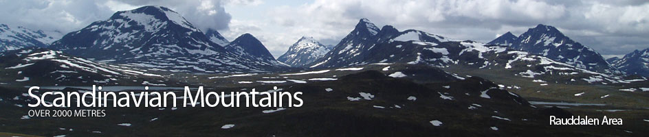
Scandinavian Mountains over 2000 metres - James Baxter
Areas › Rauddalen Area › Walking Routes › Ra.4
| Ra.4 | Gjendebu lodge to Skogadalsbøen lodge via Øvre Mjølkedalen |
|---|---|
| 10-11 hours / 31km 670m |
A path marked in cairns in the summer. Unmarked ski route in the winter. |
Leave Gjendebu lodge and head west up the marked path for 300 metres to the first bridge over a branch of the Storåe river in its lush delta. Cross the bridge and then another one 200 metres later over another branch to cross a flat meadow for ½ km before entering the lush birch woods thick with wild flowers.
Continue up through the woods for another 2½ km until the trees become more gnarled and peter out into willow scrub under the imposing cliffs of Gjendetunga. Here there is a seasonal bridge to the south side of the river and wonderful views south to the alpine Slettmark massif.
Continue up the marked path for another 2½ km across tundra, now under the knobbly south side of Tungepiggan hill to arrive at a junction. The path Ra.3 heads straight on to Fondsbu lodge, while you want the marked fork to the west which climbs up small side valley between the Tungepiggan hill and Geithøi knoll for 1½ km to reach another junction beside a lake. The marked north fork goes to Olavsbu cabin on path Ra.6. The unmarked south fork goes over the plateau and then drops steeply down to Fondsbu lodge on path Ra.11.
The middle fork is the one to take and it continues due west up a smaller valley towards the massive bulk of Snøholstind. After climbing up this stony valley for ½ hour you reach a high stony plateau dotted with lakes. Cross this plateau for another ½ hour passing between lakes to reach a large stream tumbling out of a lake. This unbridged stream must be jumped or waded. From the crossing head along the stone south shore of Snøholsvatnet lake for 3 km or 1 hour passing into the deep cleft between Høgbrothøgdi and Snøholstind.
The marked track leaves the rocky shoreline at a bay and traverses up a stony slope for a short ½ hour to reach a marked junction and a wonderful view into the U shaped, lake filled Øvre Mjølkedalen valley. The north path Ra.5 heads down the rocky slope to a lake and on to Olavsbu cabin while the southern path Ur.1 heads down to Fondsbu lodge. Take neither but continue ahead down into the deep valley with its string of lakes. When you arrive at the first lake there is a shortcut path from Fondsbu lodge into this valley which you ignore.
Follow the rocky north shore of this lake to the outflow then cross pleasant grassy area, passing a tarn before you cross over the stream to the west side of the valley before coming to a larger lake. The steep slopes of the majestic Mjølkedalstind rise steeply to the east of this lake. Continue to the north end of the lake where there is another pleasant grassy plain and a great view down Skogadalen valley unfolds. A km after the end of the larger lake the path, Ra.7, from Olavsbu cabin joins from the north after steep descent down the valley side. From this junction continue west down the lazy pleasant valley for 4 km on the south a series of idyllic tarns on the valley floor until you reach a lip.
Descend down this 100 metres drop into a basin of willow scrub and the upper limits of the birch forest. Once in the basin enter the lush flower-filled forest and head down the valley for 5 km with the proud Gjertvasstind as a backdrop. Just before Skogadalsbøen lodge the marked path crosses a large bridge over to the north side of the Skogadøla river.
During the winter this route can be followed but is unmarked. There is a small avalanche risk in Øvre Mjølkedalen which needs to be assessed.